1
/
of
1
My Store
RARE 1877 Jerusalem Palestine Plan Map Fayard, R. Hausermann Atlas Universel
RARE 1877 Jerusalem Palestine Plan Map Fayard, R. Hausermann Atlas Universel
Regular price
$249.00 USD
Regular price
Sale price
$249.00 USD
Quantity
Couldn't load pickup availability
RARE 1877 Jerusalem Palestine Plan Map Fayard, R. Hausermann Atlas Universel
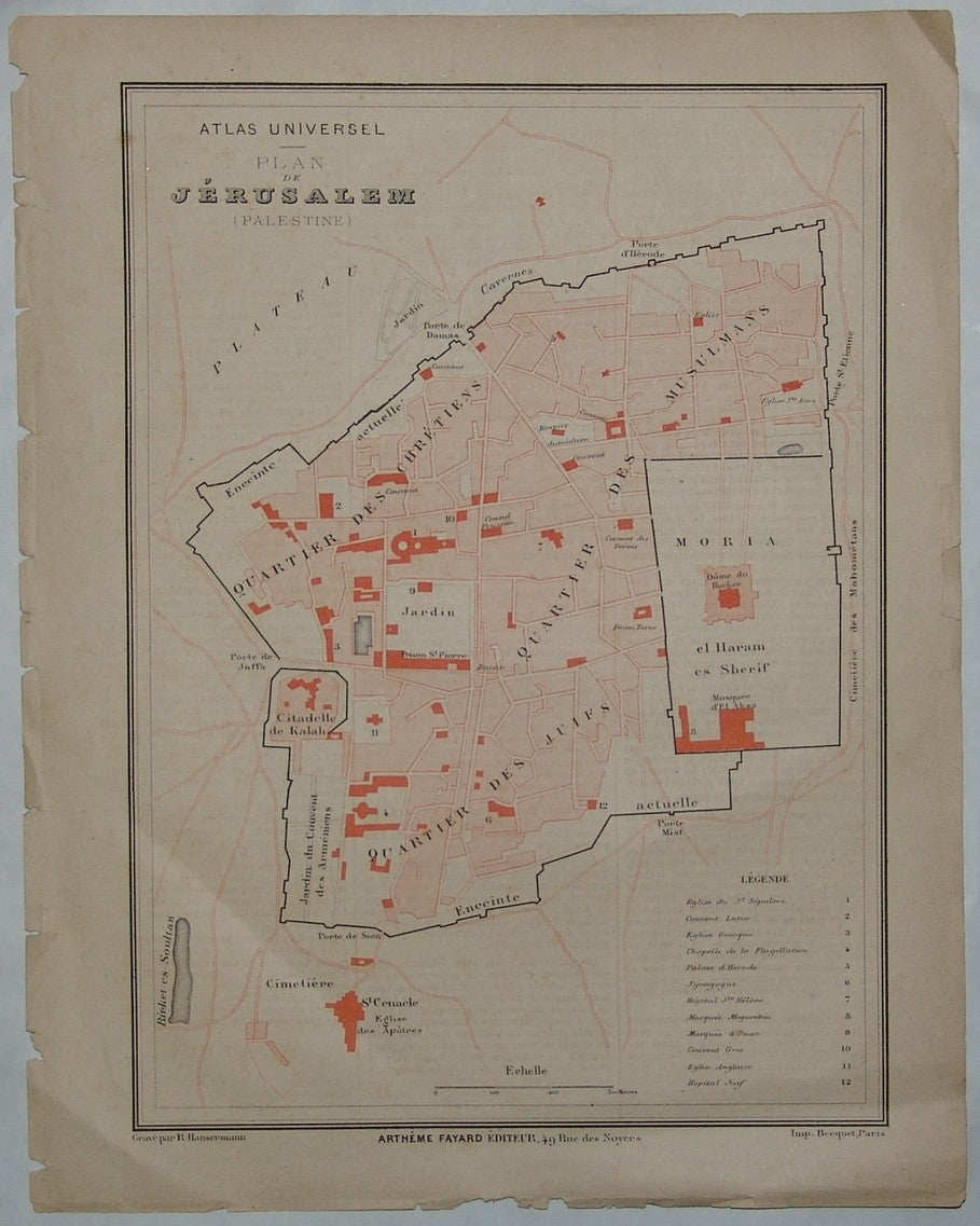
Plan De Jerusalem By Fayard. 1877. The map was drawn and engraved by R. Hausermann and published in Paris by Fayard Freres in their “Atlas Universel”. Year Printed: 1877. Size (W X H): 23.5 X 31.5 cm (9 ½ X 12 ½ inch). Original color printing with French legend. Scale: 70 meter to a cm. Map Description: The map extends from the valley of Jehosaphat in the north through Saint Cenacle Church in the south. The city is divided into 4 parts: Moriah (the Temple Mount), Musulmans, Juifs and Chretiens Quartiers. )The population of Jerusalem during the 1880’s totals approximately 18,000 Jews, 10,000 Arabs and 3000 Christians). Index and Explanations: Name list of 12 places of public importance are marked.
for condition see pictures
Share